(Press-News.org) GAINESVILLE, Fla. — In the last 30 years, more than 90 percent of the reef-building coral responsible for maintaining major marine habitats and providing a natural barrier against hurricanes in the Caribbean has disappeared because of a disease of unknown origin.
Now a University of Florida geographer and his colleagues applied Geographic Information Systems, known as GIS — as well as software previously used to examine human illness — to show where clusters of diseased coral exist. Their findings, published this month in the journal PLoS One, may help scientists derive better hypotheses to determine what contributes to coral disintegration.
"What you'll find is that spatial techniques have been used relatively little in the coral research community," said paper co-author Jason Blackburn, a UF professor of geography and member of UF's Emerging Pathogens Institute. "With these methods, we gain a better understanding of the disease's distribution across the reef."
Microbiologists and toxicologists often run laboratory tests on small samples of Acropora species of coral to determine the factors that contribute to white-band disease, known as WBD. It's visually identified as a white band moving from the base of the coral up, killing the coral tissue as it goes, leaving only the exposed coral skeleton behind.
Laboratory results spur a range of theories of causation — anything from opportunistic pathogens to specific bacterial infections. Other scientists suggest that WBD is not the result of an outside agent, such as bacteria, but rather a stress response from the coral in reaction to changes in the marine environment, such as ocean pollution and rising ocean temperatures due to climate change.
Yet the cause remains unclear. The goal of this current study was to use GIS and spatial analysis to search for patterns in a WBD outbreak that might point to a mode of transmission or cause, Blackburn said.
"What we wanted to test is how much data scientists should gather to get the full picture of disease," he said. "What we found was that colony-level sampling, where individual Acropora colonies are counted and checked for disease, can show a far different picture of white-band disease than where only presence/absence of coral and disease are mapped."
The researchers used data gathered in 2004 from scientists stationed at Buck Island National Monument in the U.S. Virgin Islands. Rather than determining only whether coral was affected by WBD, samplers at the station counted the individual number of healthy and non-healthy coral colonies. University researchers were then able to use this information in the Disease Mapping and Analysis Program, known as DMAP. The free software, designed by the University of Iowa initially to study Sudden-Infant Death Syndrome, was used to create maps of WBD prevalence and to locate areas with significant disease clustering.
"While the focus of our study was on a specific white-band disease outbreak, our methods could be used to determine if there's a spatial component to just about any type of situation that might be present in an underlying population," said Jennifer Lentz, a Louisiana State University graduate student who is lead author on the paper. "For example, you could use these same techniques to determine whether people with cancer are clustered in a given geographical area, and if so is there something about those locations that might be contributing to the increased prevalence of cancer."
The researchers determined that 3 percent of the Acropora coral around Buck Island had WBD. They also found the locations of significant disease clusters, information scientists can then use to narrow where they should take samples for further laboratory tests. This is the first of several studies established by the researchers exploring which types of spatial analysis are the most appropriate for various types of coral data from the Caribbean.
For thousands of years, Acropora was the predominant coral in the Caribbean, but more than three decades of disease have destroyed the species ability to survive, forcing marine life out of their coral habitats, which exposes them to attack by predators.
"When these structures are gone, certain fish species have nowhere to go," said Lentz. "Whole marine communities start to collapse."
###
Credits
Writer
Claudia Adrien, c.adrien@epi.ufl.edu
Source
Jason Blackburn, jkblackburn@ufl.edu, 352-273-9374
Source
Jennifer Lentz, jlentz1@lsu.edu, 225-578-6308
Geographic analysis offers new insight into coral disease spread
2011-08-01
ELSE PRESS RELEASES FROM THIS DATE:
NASA identifies the areas of Tropical Storm Muifa's strength
2011-08-01
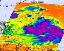
The strongest thunderstorms that make up tropical storm Muifa are on the storm's eastern and southern sides, according to infrared imagery from NASA's Aqua satellite. The northern side is being weakened by a nearby weather system.
Tropical Storm Muifa is moving through the western North Pacific Ocean, and had strengthened during the early morning hours of July 28. On July 27, it was tropical depression 11W and winds have since increased to 40 knots (46 mph/74 kmh).
When NASA's Aqua satellite passed over Tropical Storm Muifa the Atmospheric Infrared Sounder (AIRS) instrument ...
NASA eyes Tropical Storm Nock-Ten's heavy rains for Hainan Island and Vietnam
2011-08-01
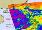
Infrared satellite imagery from NASA's Aqua satellite shows bands of strong thunderstorms wrapping around the center of Tropical Storm Nock-Ten as it makes its way through the South China Sea and two landfalls on Hainan Island and in Vietnam.
Bands of strong thunderstorms that make up tropical storm Nock-ten were visible in an infrared image captured on July 28 by the Atmospheric Infrared Sounder (AIRS) instrument that flies on NASA's Aqua satellite. The colder the cloud tops, the higher the thunderstorms and the stronger they are, and cloud top temperatures over a large ...
NASA measures wildfire pollution pour over Niagara Falls
2011-08-01
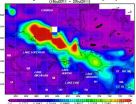
Water isn't the only thing pouring over Niagara Falls. Pollution from fires in Ontario, Canada is also making the one thousand mile trip, while being measured by NASA's Aqua satellite.
One instrument that flies aboard two of NASA's satellites has provided two views of the pollution from the fires in Ontario. The Moderate Resolution Imaging Spectroradiometer, or MODIS instrument, flies onboard NASA's Aqua and Terra satellites. MODIS has provided a visible look at the smoke and pollution that has spread over Niagara Falls and east to Nova Scotia.
As of July 20, the Canadian ...
Cash Advances US Provides Fast Cash Loans Online With No Credit Check
2011-08-01
Less-than-perfect credit score can wipe off any opportunity to get some cash you need at the moment as most of the lenders consider people with bad credit history as high-risk borrowers. However, Cash Advances US offers particular cash loans with no credit check which are available online. The service was actually designed specially for consumers with damaged credit report who often face troubles applying for some extra money.
It's fast and simple to take out online payday advance loans performed by the company as the application process is held totally on the Internet. ...
Using a 'systems biology' approach to look under the hood of an aggressive form of breast cancer
2011-08-01
SEATTLE – Using a "systems biology" approach – which focuses on understanding the complex relationships between biological systems – to look under the hood of an aggressive form of breast cancer, researchers for the first time have identified a set of proteins in the blood that change in abundance long before the cancer is clinically detectable. The findings, by co-authors Christopher Kemp, Ph.D., and Samir Hanash, M.D., Ph.D., members of Fred Hutchinson Cancer Research Center's Human Biology and Public Health Sciences divisions, respectively, are published online ahead ...
SOHO watches a comet fading away
2011-08-01
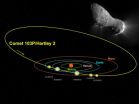
On Nov. 4, 2010, NASA's EPOXI spacecraft came within 450 miles of Comet Hartley 2, a small comet not even a mile in diameter, which takes about six and a half years to orbit the sun. Designated officially as 103P/Hartley 2, the comet thus became the fifth for which scientists have collected close-up images.
But the comet was also observed from another spacecraft: the Solar and Heliospheric Observer (SOHO), better known for its observations of the sun. Together, the two returned data about what appears to be an irregular comet, belching chunks of ice and losing water at ...
Fresh Produce Clothing's Summer-Fall Collections Feature Unique Pieces of Wearable Works of Art
2011-08-01
Fresh Produce customers can make an artful statement when they wear the eclectic prints featured in its latest collections of effortless and spirited looks. The inspired prints are available in a variety of new styles and fabrications from cool cotton voile to comfy cotton jersey and versatile rayon-lycra.
This summer's standout print is the Blue Tahitian Flower. Fresh Produce women adore this romantic watercolor-inspired motif. Its look and feel is "pure summer" with beautiful tropical flowers captured in soft, watery hues and translated to new chic tunics, ...
An unexpected clue to thermopower efficiency
2011-08-01
Scientists at the U.S. Department of Energy's Lawrence Berkeley National Laboratory (Berkeley Lab) and their colleagues have discovered a new relation among electric and magnetic fields and differences in temperature, which may lead to more efficient thermoelectric devices that convert heat into electricity or electricity into heat.
"In the search for new sources of energy, thermopower – the ability to convert temperature differences directly into electricity without wasteful intervening steps – is tremendously promising," says Junqiao Wu of Berkeley Lab's Materials ...
Boloco Earns Another 'Green' Star
2011-08-01
Back in March 2008 boloco, a chain of inspired burrito restaurants, became the first fast-casual chain in New England to become a Certified Green Restaurant by the Green Restaurant Association (GRA). But when boloco found out an even higher level of certification could be achieved - well, let's just say they reached for the stars. Boloco is now the first chain* of restaurants to become a 2 Star Certified Green Restaurant across all of their 17 locations.
For each of boloco's 17 locations to earn the GRA's rigorous two-star certification, they had to be inspected and ...
New study outlines economic and environmental benefits to reducing nitrogen pollution
2011-08-01
New, York, NY—July 28, 2011—A new study co-authored by Columbia Engineering professor Kartik Chandran and recently published in the journal, Environmental Science & Technology, shows that reducing nitrogen pollution generated by wastewater treatment plants can come with "sizable" economic benefits, as well as the expected benefits for the environment.
Chandran was one of five scientists from around the U.S. who worked on the study, along with James Wang of NOAA's Air Resources Laboratory and formerly of Environmental Defense Fund (EDF); Steve Hamburg, Chief Scientist ...
