NASA's Aqua satellite eyeing Tropical Cyclone Nilofar in Arabian Sea
Published 2014-10-27 · Original archive entry · Explore research explainers
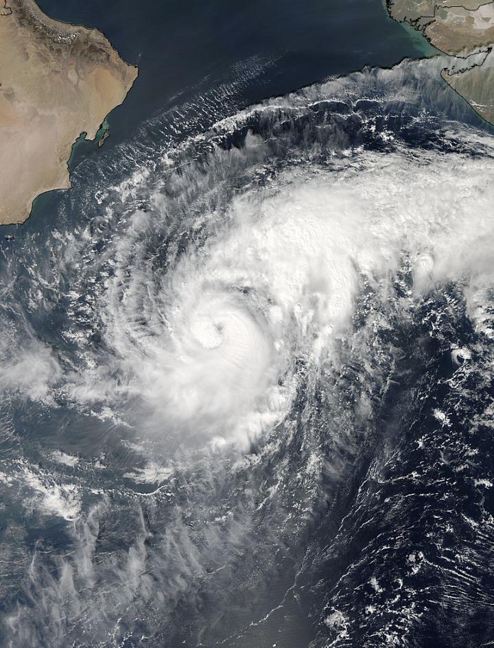
Tropical Cyclone 04A continues to intensify and had been renamed Tropical Cyclone Nilofar when NASA's Aqua satellite passed overhead on Oct. 27.
The MODIS instrument aboard Aqua captured a visible image of Nilofar that showed a ring of strong thunderstorms around the center of circulation and bands of thunderstorms wrapping into the low-level center from the east and west.
Nilofar attained hurricane strength on Oct. 27, when maximum sustained winds were near 75 knots (86 mph/139 kph) at 1500 UTC (11 a.m. EDT). Nilofar was centered near 15.2 north latitude and 62.2 east longitude, about 381 nautical miles south-southeast of Masirah Island and was crawling at 2 knots (3.73 mph/3.7 kph) to the west-northwest.
The Joint Typhoon Warning Center expects Nilofar to meander in a northerly direction for a couple of days before taking a more northwesterly path toward northwestern India where it is expected to make landfall on Oct. 31.
The MODIS instrument aboard Aqua captured a visible image of Nilofar that showed a ring of strong thunderstorms around the center of circulation and bands of thunderstorms wrapping into the low-level center from the east and west.
Nilofar attained hurricane strength on Oct. 27, when maximum sustained winds were near 75 knots (86 mph/139 kph) at 1500 UTC (11 a.m. EDT). Nilofar was centered near 15.2 north latitude and 62.2 east longitude, about 381 nautical miles south-southeast of Masirah Island and was crawling at 2 knots (3.73 mph/3.7 kph) to the west-northwest.
The Joint Typhoon Warning Center expects Nilofar to meander in a northerly direction for a couple of days before taking a more northwesterly path toward northwestern India where it is expected to make landfall on Oct. 31.
INFORMATION:
Rob Gutro
NASA's Goddard Space Flight Center