Suomi-NPP satellite sees formation of Tropical Depression Chan-Hom
Published 2015-06-30 · Original archive entry · Explore research explainers
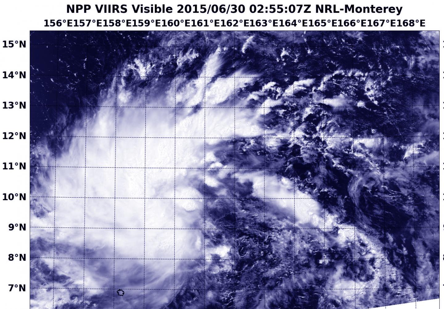
NASA-NOAA's Suomi NPP Satellite passed over the newborn ninth tropical depression of the Northwestern Pacific Ocean typhoon season on June 30.
At 02:55 UTC (10:55 p.m. EDT, June 29), the VIIRS or Visible Infrared Imaging Radiometer Suite (VIIRS) instrument aboard NASA-NOAA's Suomi satellite captured a visible image of the newly developed depression. The VIIRS image revealed bands of thunderstorms wrapping into the low-level center from the north and western quadrants.
VIIRS collects visible and infrared imagery and global observations of land, atmosphere, cryosphere and oceans. VIIRS flies aboard the Suomi NPP satellite, which is managed by both NASA and NOAA.
On Tuesday, June 30, 2015, Tropical Depression Chan-Hom was born. By 1500 UTC (11 a.m. EDT), Chan-Hom's maximum sustained winds were near 30 knots (35.5 mph/55.5 kph). Chan-Hom was centered near 9.7 North latitude and 160.0 East longitude, about 204 nautical miles northeast of Pohnpei. Chan-Hom was moving to the west at 3 knots (3.5 mph/5.5 kph).
Chan-Hom is expected to strengthen to tropical storm status and move to the west, then northwest. The Joint Typhoon Warning Center expects Chan-Hom to pass north of Fananu and then strengthen to typhoon status on July 3, while remaining at sea, east of Guam.
At 02:55 UTC (10:55 p.m. EDT, June 29), the VIIRS or Visible Infrared Imaging Radiometer Suite (VIIRS) instrument aboard NASA-NOAA's Suomi satellite captured a visible image of the newly developed depression. The VIIRS image revealed bands of thunderstorms wrapping into the low-level center from the north and western quadrants.
VIIRS collects visible and infrared imagery and global observations of land, atmosphere, cryosphere and oceans. VIIRS flies aboard the Suomi NPP satellite, which is managed by both NASA and NOAA.
On Tuesday, June 30, 2015, Tropical Depression Chan-Hom was born. By 1500 UTC (11 a.m. EDT), Chan-Hom's maximum sustained winds were near 30 knots (35.5 mph/55.5 kph). Chan-Hom was centered near 9.7 North latitude and 160.0 East longitude, about 204 nautical miles northeast of Pohnpei. Chan-Hom was moving to the west at 3 knots (3.5 mph/5.5 kph).
Chan-Hom is expected to strengthen to tropical storm status and move to the west, then northwest. The Joint Typhoon Warning Center expects Chan-Hom to pass north of Fananu and then strengthen to typhoon status on July 3, while remaining at sea, east of Guam.
INFORMATION: