(Press-News.org) Farmers are using maps created with free data from NASA and the U.S. Geological Survey's Landsat satellites that show locations that are good and not good for growing crops.
Farmer Gary Wagner walks into his field where the summer leaves on the sugar beet plants are a rich emerald hue -- not necessarily a good color when it comes to sugar beets, either for the environment or the farmer. That hue tells Wagner that he's leaving money in the field in unused nitrogen fertilizer, which if left in the soil can act as a pollutant when washed into waterways, and in unproduced sugar, the ultimate product from his beets.
The leaf color Wagner is looking for is yellow. Yellow means the sugar beets are stressed, and when the plants are stressed, they use more nitrogen from the soil and store more sugar. Higher sugar content means that when Wagner and his family bring the harvest in, their farm, A.W.G. Farms, Inc., in northern Minnesota, makes more dollars per acre, and they can better compete on the world crop market.
To find where he needs to adjust his fertilizer use—apply it here or withhold it there—Wagner uses a map of his 5,000 acres that span 35 miles. The map was created using free data from NASA and the U.S. Geological Survey's Landsat satellites and tells him about growing conditions. When he plants a different crop species the following year, Wagner's map will tell him which areas of the fields are depleted in nitrogen so he can apply fertilizer judiciously instead of all over.
A farmer needs to monitor his fields for potential yield and for variability of yield, Wagner says. Knowing how well the plants are growing by direct measurement has an obvious advantage over statistically calculating what should be there based on spot checks as he walks his field. That's where remote sensing comes in, and NASA and the U.S. Geological Survey's Landsat satellites step into the spotlight.
The Sensors in the Sky "Trip the Light Fantastic"
Providing the longest, continuous record of observations of Earth from space, Landsat images are critical to anyone—scientist or farmer—who relies on month-to-month and year-to-year data sets of Earth's changing surface. Landsat 1 launched in 1972. The Landsat Data Continuity Mission (LDCM), the eighth satellite in the series, will launch in 2013 and will bring two sensors—the Operational Land Imager (OLI) and the Thermal Infrared Sensor (TIRS)—into low orbit over the Earth to continue the work of their predecessors as they image our planet's land surface.
Land features tell the sensors their individual characteristics through energy. Everything on the land surface reflects and radiates energy—you, your backyard trees, that rocky outcropping, and a field where a farmer is growing a crop of sugar beets. The sensors on LDCM will measure energy at wavelengths both within the visible spectrum—what people can see—and at wavelengths that only the sensors, and some other lucky species, such as bees and spiders, can see.
OLI will measure energy in nine visible, near infrared, and short wave infrared portions, or bands, of the electromagnetic spectrum, and TIRS will measure energy in two thermal infrared bands. And that's what makes them such powerful tools.
Jim Irons, NASA Project Scientist for LDCM at NASA's Goddard Space Flight Center, Greenbelt, Md., says that the instruments will deliver data-rich images that tell a deeper story than your average photograph of how the land changes over time.
Wagner's map—a special kind of map known as a zone map—shows the difference between healthy and stressed plants by representing the amount of light they're reflecting in different bands of the electromagnetic spectrum. To display this information on his map, the visible colors of light—red, green, and blue—are each assigned to a different band. Red, for example, is assigned to the near-infrared band that isn't visible to humans. Healthy leaves strongly reflect the invisible, near-infrared energy. Therefore green, lush sugar beets pop out in bright red on Wagner's map while the yellow-leaved stressed plants appear as a duller red. Wagner can use this map to track and document changes in his crop's condition throughout the season and between seasons. As a tool, this map supports and enhances his on-the-ground crop analyses with independent and scientific observations from space.
Different band combinations tell farmers—and scientists, insurance agents, water managers, foresters, mapmakers, and many other types of users—different information. Additionally, since the Landsat data is digital, computers can be trained to use all the bands to rapidly recognize and differentiate features across the landscape and to recognize change over time with multiple images.
"Therein lies the power of the Landsat data archive," says Irons. "It is a multi-band analysis across the landscape and over a 40-year time span."
Both OLI and TIRS use new "push-broom" technology, in which a sensor uses long arrays of light-sensitive detectors to collect information across the field of view, as opposed to older sensors that sweep mirrors side-to-side. The new technology improves on earlier instruments because the sensors have fewer moving parts, which will improve their reliability.
OLI will also be more sensitive to electromagnetic radiation than previous Landsat sensors, which is akin to giving users access to a new and improved ruler with markings down to one-sixty-fourth of an inch versus markings at every quarter inch. For Wagner, this means that next summer with LDCM in orbit, he will be able to better discriminate the degree of stress on his sugar beets, giving him a more finely tuned view of what his plants need across the field.
The View of the Field is the Right Fit for its Purpose
Each step of the way, OLI will look at Earth with a 15-meter (49 foot) panchromatic and a 30-meter (98 foot) multispectral spatial resolution along a ground swath that is 185 kilometers (115 miles) wide. TIRS will measure two thermal infrared spectral bands with a spatial resolution of 100 meters (328 feet) and cover the same size swath as OLI.
Different scale resolutions—low, moderate, and high—deliver different levels of detail in remote sensing images, and each has its purpose. The 30-meter (98 foot) resolution of the Landsat images Wagner uses allows him to see what is happening on his spread, quarter-acre by quarter-acre. He doesn't need a view so narrow that the high resolution image tells him who's sitting in the combine parked in his field, or a view so big that it shows him smoke from forest fires drifting over the North American continent with no detail on his farm.
The moderate resolution also means Landsat satellites are able to fly over the same piece of real estate more frequently than high resolution satellites. Once every sixteen days, Landsat 7 in orbit now or LDCM after it launches, will revisit Wagner's farm, and every other place on Earth, too, for global coverage. "We're looking forward to having a real quality instrument in space," says Irons, who is excited about having OLI and TIRS come online. He says the Landsat 30-meter resolution has been assessed in the scientific literature as being a suitable resolution for observing land cover and land use change at the scale in which humans interact with and manage land. The sensors will record 400 scenes a day, giving users 150 more scenes than previous instruments. Data from both of the sensors will be combined in each image.
The Legacy in the Landsat Mission is its Continuity
In daily operations on his farm, Wagner has used Landsat data in near real time. He's anxious for the launch of LDCM and NASA's newest sensors, OLI and TIRS, because not having the remote sensing data really puts him in a bind. A lack of current satellite data disrupts Wagner's understanding of what his plants need, what the soil needs, the long-term performance history of his place, and his budget.
For now, with his zone map in hand, Wagner adjusts his care for his sugar beet crop, allowing the plants to deplete fertilizer in the soil so he can change the bright red on the satellite image to the yellow of sweet beets in his field.
INFORMATION:
Landsat satellites find the 'sweet spot' for crops
2012-09-28
ELSE PRESS RELEASES FROM THIS DATE:
NASA sees a western weakness in Tropical Storm Miriam
2012-09-28
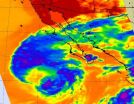
NASA infrared satellite imagery showed Tropical Storm Miriam had strong convection and thunderstorm activity in all quadrants of the storm on Sept. 26, except the western quadrant. That activity waned dramatically in 24 hours because of strong wind shear and cooler sea surface temperatures.
The Atmospheric Infrared Sounder (AIRS) instrument that flies aboard NASA's Aqua satellite captured infrared data on Tropical Storm Miriam on Sept. 26 at 2047 UTC, when it was off the coast of Baja California. Strongest thunderstorms with very cold cloud top temperatures appear to ...
NASA sees a wide-eyed Super Typhoon Jelawat
2012-09-28
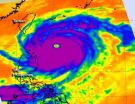
One day ago, Super Typhoon Jelawat's eye was about 25 nautical miles in diameter, today, Sept. 27, NASA satellite data indicated that eye has grown to 36 nautical miles!
The latest infrared image from the Atmospheric Infrared Sounder (AIRS) instrument that flies on NASA's Aqua satellite shows a clear eye in Typhoon Jelawat on Sept. 25. The cloud top temperatures of the thunderstorms surrounding the eye exceed -63 Fahrenheit (-52 Celsius) indicating that they are very powerful and heavy rainmakers.. Jelawat also has a rounded shape indicating that circulation is strong ...
NASA sees Tropical Storm Ewiniar embedded in low pressure
2012-09-28
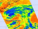
NASA's Aqua satellite passed over Tropical Storm Ewiniar and noticed strong convection still persists in the storm, despite now being embedded in a subtropical area of low pressure off the coast of Japan.
As Tropical Storm Ewiniar continues to move northward it wound up in an elongated area of low pressure (called a trough) off Japan's east coast. The trough is bringing a strong westerly flow of air into Ewiniar. Despite being battered by those winds, infrared data from the Atmospheric Infrared Sounder (AIRS) instrument that flies aboard NASA's Aqua satellite is showing ...
Study shows the MDHearingAid to be an effective low cost solution to hearing loss
2012-09-28
Washington, D.C. - A study presented at the American Academy of Otolaryngology - Head & Neck Surgery Foundation Annual Meeting in Washington, D.C. shows that the MD Hearing Aid line offers a reasonable low-cost solution to those who are not using hearing aids or other amplification devices because of cost concerns.
In the study, researchers at the Michigan Ear Institute sought to evaluate a novel, inexpensive (under $200.) over- the-counter hearing aid regarding to its acoustic properties and also to test the hearing aid on patients with varying levels of hearing loss ...
Major genetic discovery explains 10 percent of aortic valve disease
2012-09-28
This press release is available in French and German.MONTREAL, Canada, September 28, 2012 - Researchers at the Sainte-Justine University Hospital Center and University of Montreal have identified genetic origins in 10% of an important form of congenital heart diseases by studying the genetic variability within families. "This is more than the sum of the genes found to date in all previous studies, which explained only 1% of the disease, says Dr. Marc-Phillip Hitz, lead author of the study published in PLOS Genetics, under the direction of Dr. Gregor Andelfinger, pediatric ...
Making headway on beta-blockers and sleep
2012-09-28
Boston, MA—Over 20 million people in the United States take beta-blockers, a medication commonly prescribed for cardiovascular issues, anxiety, hypertension and more. Many of these same people also have trouble sleeping, a side effect possibly related to the fact that these medications suppress night-time melatonin production. Researchers at Brigham and Women's Hospital (BWH) have found that melatonin supplementation significantly improved sleep in hypertensive patients taking beta-blockers.
The study will be electronically published on September 28, 2012 and will be ...
Effective HIV care benefited all HIV patients, regardless of demographics and behavioral risk
2012-09-28
Improved treatment options, a multi-pronged treatment model, and federal funding from the Ryan White Program have helped an inner city Baltimore clinic improve outcomes for HIV patients across all groups, including those most often hardest hit by the disease. Published in Clinical Infectious Diseases, the results from the 15-year analysis of patients at a clinic serving a primarily poor, African-American patient population with high rates of injection drug use demonstrate what state-of-the-art HIV care can achieve, given appropriate support.
Current antiretroviral therapy ...
Eliminating invasive cervical cancer possible, Moffitt Cancer Center researchers report
2012-09-28
Researchers at Moffitt Cancer Center and colleagues at the University of South Florida and The Ohio State University have published a paper in the September issue of Cancer Epidemiology, Biomarkers & Prevention that provides an overview on preventing invasive cervical cancer.
"The good news is that over the past several decades, the incidence of invasive cervical cancer has declined dramatically," said senior author Anna R. Giuliano, Ph.D., director of Moffitt's Center for Infection Research in Cancer and senior member of the Cancer Epidemiology Department. "The bad ...
Gout guidelines arm patients and physicians with tools to fight painful disease
2012-09-28
Gout is one of the most common forms of inflammatory arthritis, affecting nearly 4% of adult Americans. Newly approved guidelines that educate patients in effective methods to prevent gout attacks and provide physicians with recommended therapies for long-term management of this painful disease are published in Arthritis Care & Research, a peer-reviewed journal of the American College of Rheumatology (ACR).
Uric acid is produced by the metabolism of purines, which are found in foods and human tissue. When uric acid levels increase, crystals can form and deposit in joints, ...
Eating cherries lowers risk of gout attacks by 35%
2012-09-28
A new study found that patients with gout who consumed cherries over a two-day period showed a 35% lower risk of gout attacks compared to those who did not eat the fruit. Findings from this case-crossover study published in Arthritis & Rheumatism, a journal of the American College of Rheumatology (ACR), also suggest that risk of gout flares was 75% lower when cherry intake was combined with the uric-acid reducing drug, allopurinol, than in periods without exposure to cherries or treatment.
Previous research reports that 8.3 million adults in the U.S. suffer with gout, ...


