NASA-NOAA's Suomi NPP satellite sees Tropical Storm Kammuri coming together
Published 2014-09-25 · Original archive entry · Explore research explainers
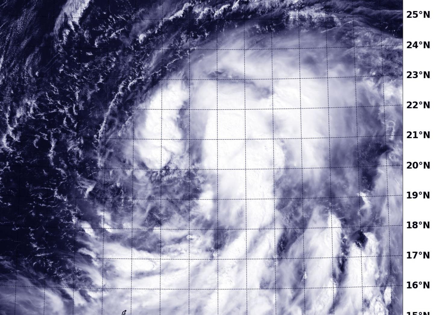
When NASA-NOAA Suomi NPP satellite passed over Tropical Storm Kammuri the VIIRS instrument aboard took a visible picture of the storm that showed bands of thunderstorms wrapped around its center. The storm appears to be coming together as circulation improves and bands of thunderstorms have been wrapping into the low-level center of circulation.
NASA-NOAA's Suomi NPP satellite passed over Tropical Storm Kammuri on Sept. 25 at 03:13 UTC (Sept. 24 at 11:13 p.m. EDT) and the Visible Infrared Imaging Radiometer Suite (VIIRS) instrument aboard captured a visible picture of the storm. The VIIRS instrument revealed strong thunderstorms around the center of circulation an in broken bands to the northwest and northeast of the center. Bands of thunderstorms were also forming south of the center and spiraling into the middle of the storm.
On Sept. 25 at 1500 UTC (11 a.m. EDT), Kammuri's maximum sustained winds were near 45 knots (83.3 mph/51.7 kph). It was centered near 20.8 north latitude and 146.5 east longitude, about 400 nautical miles southeast of Iwo To. Kammuri was moving to the north-northwest at 7 knots (8 mph/13 kph).
Kammuri is still forecast to intensify as it moves in a north-northwesterly direction through warm sea surface temperatures, toward the island of Iwo To. Forecasters at the Joint Typhoon Warning Center expect Kammuri to be typhoon strength as it passes east of the island of Iwo To on Sept. 27.
INFORMATION:
NASA-NOAA's Suomi NPP satellite passed over Tropical Storm Kammuri on Sept. 25 at 03:13 UTC (Sept. 24 at 11:13 p.m. EDT) and the Visible Infrared Imaging Radiometer Suite (VIIRS) instrument aboard captured a visible picture of the storm. The VIIRS instrument revealed strong thunderstorms around the center of circulation an in broken bands to the northwest and northeast of the center. Bands of thunderstorms were also forming south of the center and spiraling into the middle of the storm.
On Sept. 25 at 1500 UTC (11 a.m. EDT), Kammuri's maximum sustained winds were near 45 knots (83.3 mph/51.7 kph). It was centered near 20.8 north latitude and 146.5 east longitude, about 400 nautical miles southeast of Iwo To. Kammuri was moving to the north-northwest at 7 knots (8 mph/13 kph).
Kammuri is still forecast to intensify as it moves in a north-northwesterly direction through warm sea surface temperatures, toward the island of Iwo To. Forecasters at the Joint Typhoon Warning Center expect Kammuri to be typhoon strength as it passes east of the island of Iwo To on Sept. 27.
INFORMATION: