(Press-News.org) It’s easier than ever to view maps of any place you’d like to go — by car, that is. By foot is another matter. Most cities and towns in the U.S. do not have sidewalk maps, and pedestrians are usually left to fend for themselves: Can you walk from your hotel to the restaurants on the other side of the highway? Is there a shortcut from downtown to the sports arena? And how do you get to that bus stop, anyway?
Now MIT researchers, along with colleagues from multiple other universities, have developed an open-source tool that uses aerial imagery and image-recognition to create complete maps of sidewalks and crosswalks. The tool can help planners, policymakers, and urbanists who want to expand pedestrian infrastructure.
“In the urban planning and urban policy fields, this is a huge gap,” says Andres Sevtsuk, an associate professor at MIT and a co-author of a new paper detailing the tool’s capabilities. “Most U.S. city governments know very little about their sidewalk networks. There is no data on it. The private sector hasn’t taken on the task of mapping it. It seemed like a really important technology to develop, especially in an open-source way that can be used by other places.”
The tool, called TILE2NET, has been developed using a few U.S. areas as initial sources of data, but it can be refined and adapted for use anywhere.
“We thought we needed a method that can be scalable and used in different cities,” says Maryam Hosseini, a postdoc in MIT’s City Form Lab in the Department of Urban Studies and Planning (DUSP), whose research has focused extensively on the development of the tool.
The paper, “Mapping the Walk: A Scalable Computer Vision Approach for Generating Sidewalk Network Datasets from Aerial Imagery,” appears online in the journal Computers, Environment and Urban Systems. The authors are Hosseini; Sevtsuk, who is the Charles and Ann Spaulding Career Development Associate Professor of Urban Science and Planning in DUSP and head of MIT’s City Form Lab; Fabio Miranda, an assistant professor of computer science at the University of Illinois at Chicago; Roberto M. Cesar, a professor of computer science at the University of Sao Paulo; and Claudio T. Silva, Institute Professor of Computer Science and Engineering at New York University (NYU) Tandon School of Engineering, and professor of data science at the NYU Center for Data Science.
Significant research for the project was conducted at NYU when Hosseini was a student there, working with Silva as a co-advisor.
There are multiple ways to attempt to map sidewalks and other pedestrian pathways in cities and towns. Planners could make maps manually, which is accurate but time-consuming; or they could use roads and make assumptions about the extent of sidewalks, which would reduce accuracy; or they could try tracking pedestrians, which probably would be limited in showing the full reach of walking networks.
Instead, the research team used computerized image-recognition techniques to build a tool that will visually recognize sidewalks, crosswalks, and footpaths. To do that, the researchers first used 20,000 aerial images from Boston, Cambridge, New York City, and Washington — places where comprehensive pedestrian maps already existed. By training the image-recognition model on such clearly defined objects and using portions of those cities as a starting point, they were able to see how well TILE2NET would work elsewhere in those cities.
Ultimately the tool worked well, recognizing 90 percent or more of all sidewalks and crosswalks in Boston and Cambridge, for instance. Having been trained visually on those cities, the tool can be applied to other metro areas; people elsewhere can now plug their aerial imagery into TILE2NET as well.
“We wanted to make it easier for cities in different parts of the world to do such a thing without needing to do the heavy lifting of training [the tool],” says Hosseini. “Collaboratively we will make it better and better, hopefully, as we go along.”
The need for such a tool is vast, emphasizes Sevtsuk, whose research centers on pedestrian and nonmotorized movement in cities, and who has developed multiple kinds of pedestrian-mapping tools in his career. Most cities have wildly incomplete networks of sidewalks and paths for pedestrians, he notes. And yet it is hard to expand those networks efficiently without mapping them.
“Imagine that we had the same gaps in car networks that pedestrians have in their networks,” Sevtsuk says. “You would drive to an intersection and then the road just ends. Or you can’t take a right turn since there is no road. That’s what [pedestrians] are constantly up against, and we don’t realize how important continuity is for [pedestrian] networks.”
In the still larger picture, Sevtsuk observes, the continuation of climate change means that cities will have to expand their infrastructure for pedestrians and cyclists, among other measures; transportation remains a huge source of carbon dioxide emissions.
“When cities talk about cutting carbon emissions, there’s no other way to make a big dent than to address transportation,” Sevtsuk says. “The whole world of urban data for public transit and pedestrians and bicycles is really far behind [vehicle data] in quality. Analyzing how cities can be operational without a car requires this kind of data.”
On the bright side, Sevtsuk suggests, adding pedestrian and bike infrastructure “is being done more aggressively than in many decades in the past. In the 20th century, it was the other way around, we would take away sidewalks to make space for vehicular roads. We’re now seeing the opposite trend. To make best use of pedestrian infrastructure, it’s important that cities have the network data about it. Now you can truly tell how somebody can get to a bus stop.”
###
Written by Peter Dizikes, MIT News Office
Additional background
Paper: “Mapping the Walk: A Scalable Computer Vision Approach for Generating Sidewalk Network Datasets from Aerial Imagery”
https://www.sciencedirect.com/science/article/pii/S0198971523000133
END
Where the sidewalk ends
Most cities don’t map their own pedestrian networks. Now, researchers have built the first open-source tool to let planners do just that.
2023-03-15
ELSE PRESS RELEASES FROM THIS DATE:
HSE researchers examine wellbeing of Russian social media users and rank public holidays by popularity
2023-03-15
Researchers of the HSE Graduate School of Business trained a machine-learning (ML) model to infer users' subjective wellbeing from social media posts. Having processed 10 million tweets, the researchers compiled a rating of holidays celebrated in Russia based on their popularity. The New Year tops the list, but Russian-speaking users of Twitter are also happy to celebrate Defender of the Fatherland Day, International Women's Day, Victory Day and Halloween. The study findings have been published in PeerJ Computer Science.
As one of the most popular methods for ...
Good news for those with MS—fertility treatments not linked to increase in relapses
2023-03-15
EMBARGOED FOR RELEASE UNTIL 4 P.M. ET, WEDNESDAY, MARCH 15, 2023
MINNEAPOLIS – There’s good news for those with multiple sclerosis (MS). A new study has found that female participants were no more likely to have a flare-up of the disease after receiving fertility treatments than they were before their treatments. The study is published in the March 15, 2023, online issue of Neurology® Neuroimmunology & Neuroinflammation, an official journal of the American Academy of Neurology. Earlier studies had shown conflicting results. The study also found a link between the use of MS medications and a lack of increase in relapses during fertility ...
UTA team to measure pollutants in DC sewer pipe project
2023-03-15
A University of Texas at Arlington civil engineering researcher received a one-year, $300,000 competitive grant from the Water Research Foundation to evaluate a trenchless process to renew sanitary sewer pipes in Soapstone Valley Park, a popular Washington, D.C., attraction.
Mohammad Najafi, associate professor in the Department of Civil Engineering, is leading the project.
Najafi said the project will use a trenchless cured-in-place-pipe (CIPP) method that relines the old sewer pipe with new plastic material. That material then is cured in place with hot water.
“We will ...
Tak W. Mak, PhD, FAACR, selected for 2023 Pezcoller Foundation-AACR International Award for Extraordinary Achievement in Cancer Research
2023-03-15
PHILADELPHIA – The Pezcoller Foundation–American Association for Cancer Research (AACR) International Award for Extraordinary Achievement in Cancer Research will be presented to Tak W. Mak, PhD, Fellow of the AACR Academy, during the AACR Annual Meeting 2023, April 14-19 at the Orange County Convention Center in Orlando, Florida.
Mak is a senior scientist at the Princess Margaret Cancer Centre, University Health Network, as well as a university professor in the departments of medical biophysics and immunology at the Temerty Faculty of Medicine ...
Kermanshachi receives 40 Under 40 award
2023-03-15
Sharareh “Sherri” Kermanshachi, a University of Texas at Arlington associate professor of civil engineering, has received the 40 Under 40 Award from Mass Transit magazine, which recognizes individuals who have shown a capacity for innovation and demonstrated leadership and a commitment to making an impact in transit.
“I am honored and humbled to receive this award and be named to the 40 Under 40 Mass Transit award list,” said Kermanshachi, who is also director of the Resilient Infrastructures and Sustainable Environment ...
Nobel Laureate Carolyn R. Bertozzi, PhD, to receive 2023 AACR Award for Outstanding Achievement in Chemistry in Cancer Research
2023-03-15
PHILADELPHIA – The American Association for Cancer Research (AACR) will honor Nobel Laureate Carolyn R. Bertozzi, PhD, with the 2023 AACR Award for Outstanding Achievement in Chemistry in Cancer Research during the AACR Annual Meeting 2023, April 14-19 in Orlando, Florida.
Bertozzi is the Anne T. and Robert M. Bass Professor of Chemistry in the School of Humanities and Sciences and a professor (by courtesy) of chemical and systems biology and of radiology at Stanford University, an investigator with the Howard Hughes Medical Institute, and the Baker Family Director of Sarafan ChEM-H. Bertozzi is being recognized for advancing basic ...
Study offers a potential strategy to improve T cell therapy in solid tumors
2023-03-15
PHILADELPHIA – A new approach that delivers a “one-two punch” to help T cells attack solid tumors is the focus of a preclinical study by researchers from the Perelman School of Medicine at the University of Pennsylvania. The findings, published in the Proceedings of the National Academy of Sciences (PNAS), showed that targeting two regulators that control gene functions related to inflammation led to at least 10 times greater T cell expansion in models, resulting in increased antitumor immune activity and durability.
CAR T cell therapy was pioneered at Penn Medicine by ...
Uncovering the ritual past of an ancient stone monument in Saudi Arabia
2023-03-15
A comprehensive analysis of an archaeological site in Saudi Arabia sheds new light on mustatils—stone monuments from the Late Neolithic period thought to have been used for ritual purposes. Melissa Kennedy of the University of Western Australia, Perth, and colleagues, in conjunction with The Royal Commission for AlUla present these findings in the open-access journal PLOS ONE on March 15, 2023.
Built around 7,000 years ago, mustatils are rectangular, low-walled, stone structures that range from 20 to 600 meters in length. Researchers first discovered them in the 1970s, and more than 1,600 mustatils have now been discovered, primarily concentrated in northern ...
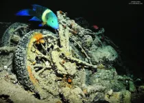
The WWII shipwreck of the SS Thistlegorm, now a popular Red Sea dive site, has formed an artificial coral reef for a diverse community of fish, according to data gathered by volunteer divers
2023-03-15
Article URL: https://journals.plos.org/plosone/article?id=10.1371/journal.pone.0282239
Article Title: Eight years of community structure monitoring through recreational citizen science at the “SS Thistlegorm” wreck (Red Sea)
Author Countries: Italy
Funding: STE project was funded by Project AWARE Foundation, ASTOI Association, Ministry of Tourism of the Arab Republic of Egypt, Settemari S.p.A Tour Operator, Scuba Nitrox Safety International, Viaggio nel Blu Diving Center. The funders had no role in study design, data collection ...
Analysis links specific skills taught by US undergraduate degree courses with graduate earnings
2023-03-15
Article URL: https://journals.plos.org/plosone/article?id=10.1371/journal.pone.0282323
Article Title: Connecting higher education to workplace activities and earnings
Author Countries: USA
Funding: This research is supported in part by the University of Pittsburgh Pitt Momentum Fund and the Center for Research Computing. This work has been supported (in part) by # 2109-33808 from the Russell Sage Foundation. Any opinions expressed are those of the principal investigator(s) alone and should not be construed as representing the opinions of the Foundation. The funders had no role in study design, data collection ...
LAST 30 PRESS RELEASES:
Scientists show how to predict world’s deadly scorpion hotspots
ASU researchers to lead AAAS panel on water insecurity in the United States
ASU professor Anne Stone to present at AAAS Conference in Phoenix on ancient origins of modern disease
Proposals for exploring viruses and skin as the next experimental quantum frontiers share US$30,000 science award
ASU researchers showcase scalable tech solutions for older adults living alone with cognitive decline at AAAS 2026
Scientists identify smooth regional trends in fruit fly survival strategies
Antipathy toward snakes? Your parents likely talked you into that at an early age
Sylvester Cancer Tip Sheet for Feb. 2026
Online exposure to medical misinformation concentrated among older adults
Telehealth improves access to genetic services for adult survivors of childhood cancers
Outdated mortality benchmarks risk missing early signs of famine and delay recognizing mass starvation
Newly discovered bacterium converts carbon dioxide into chemicals using electricity
Flipping and reversing mini-proteins could improve disease treatment
Scientists reveal major hidden source of atmospheric nitrogen pollution in fragile lake basin
Biochar emerges as a powerful tool for soil carbon neutrality and climate mitigation
Tiny cell messengers show big promise for safer protein and gene delivery
AMS releases statement regarding the decision to rescind EPA’s 2009 Endangerment Finding
Parents’ alcohol and drug use influences their children’s consumption, research shows
Modular assembly of chiral nitrogen-bridged rings achieved by palladium-catalyzed diastereoselective and enantioselective cascade cyclization reactions
Promoting civic engagement
AMS Science Preview: Hurricane slowdown, school snow days
Deforestation in the Amazon raises the surface temperature by 3 °C during the dry season
Model more accurately maps the impact of frost on corn crops
How did humans develop sharp vision? Lab-grown retinas show likely answer
Sour grapes? Taste, experience of sour foods depends on individual consumer
At AAAS, professor Krystal Tsosie argues the future of science must be Indigenous-led
From the lab to the living room: Decoding Parkinson’s patients movements in the real world
Research advances in porous materials, as highlighted in the 2025 Nobel Prize in Chemistry
Sally C. Morton, executive vice president of ASU Knowledge Enterprise, presents a bold and practical framework for moving research from discovery to real-world impact
Biochemical parameters in patients with diabetic nephropathy versus individuals with diabetes alone, non-diabetic nephropathy, and healthy controls
[Press-News.org] Where the sidewalk endsMost cities don’t map their own pedestrian networks. Now, researchers have built the first open-source tool to let planners do just that.


