Safe train transport
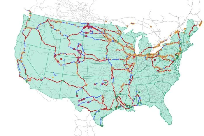
Oak Ridge National Laboratory researchers used images from a photo-sharing website to identify crude oil train routes across the nation to provide data that could help transportation planners better understand regional impacts.
More than 300 crude oil rail incidents have occurred in the U.S. over the past decade, causing adverse consequences from fire and hazardous materials leakage. However, only limited information on the transport routes has been publicly available.
In a study, ORNL researchers used geotagged online photos from Flickr to reconstruct transport paths. By linking geotagged crude oil train images with national railway networks, the team could pinpoint the areas where trains likely passed through.
“Our inferred routes aligned with approximately 96% of the documented crude oil incidents and some of these routes traversed metropolitan areas,” ORNL’s Majbah Uddin said. “With this visual data, there is now a good foundation for understanding potential risks along the rail routes.” — Jennifer Burke
END