Rogue enzymes cause numerous diseases. A new method could help design drugs to treat them.
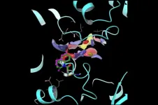
Helicases are enzymes that unwind DNA and RNA. They’re central to cellular life, implicated in a number of cancers and infections—and, alas, extraordinarily difficult to target with drugs.
Now, new research provides a powerful platform for designing covalent inhibitors tailored to target helicases. The paper, published in the Journal of the American Chemical Society, describes how researchers used this innovative new platform to design molecules that take aim at helicases involved in COVID and certain cancers.
“High-resolution structural and biochemical data alone are not sufficient ...