A $9.5 million bet that AI can map every mountain's water before it's too late
Institute of Science and Technology Austria (ISTA) | Schmidt Sciences Virtual Institute for Earth's Water (VIEW) program
Nearly two billion people drink, irrigate, and generate electricity from water that originates in mountains. Glaciers store it. Snowpacks meter it out across seasons. Permafrost holds slopes together so that water flows downhill in rivers rather than in landslides. And all three of those systems are shifting in ways that current science tracks only in fragments — a glacier here, a basin there, rarely at the resolution needed to see what is actually happening.
That gap is about to get its most ambitious attempt at a fix. The Institute of Science and Technology Austria (ISTA) will lead MountAInWater, a new project funded by Schmidt Sciences — the foundation established by former Google CEO Eric Schmidt and philanthropist Wendy Schmidt — with a grant of USD 9.5 million. The goal: produce the first-ever global reanalysis of mountain water resources at spatial resolution as fine as one kilometer, identify tipping points in the cryosphere, and translate the results into strategies that communities facing water stress can actually use.
MountAInWater was one of just four projects selected from 150 proposals under Schmidt Sciences' Virtual Institute for Earth's Water (VIEW) program, which announced a total of USD 33 million in funding ahead of the United Nations World Water Day on March 22, 2026.
Four observatories, four mountain ranges
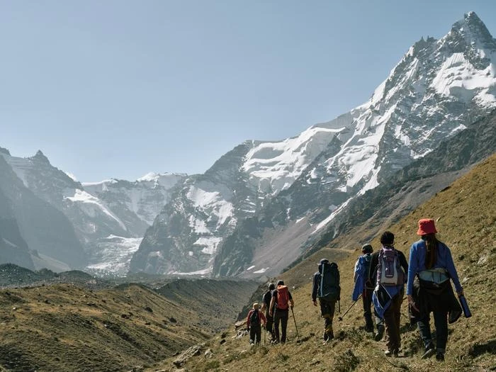
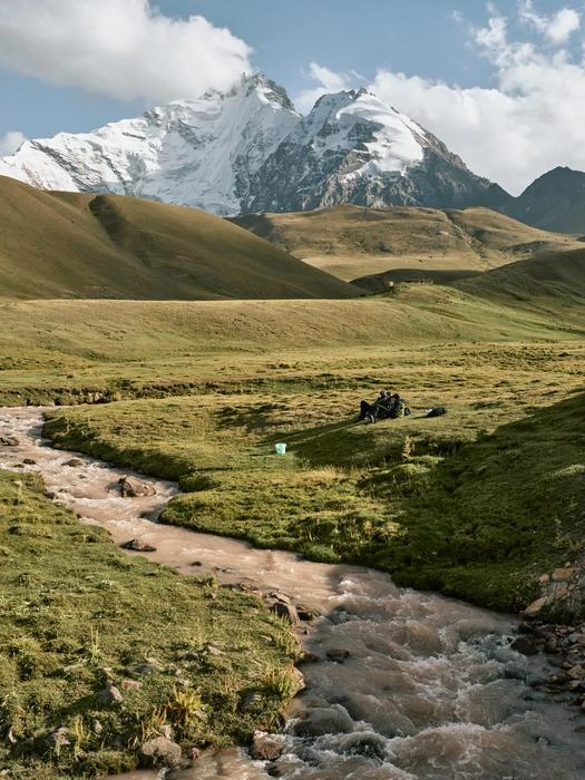
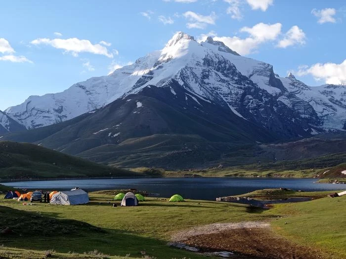
The project starts on the ground. Teams will establish what they call "supersites" — high-elevation field observatories — in the Canadian Rockies, the Andes, the Pamir Mountains, and the Himalaya. Each site will collect detailed measurements of glacial behavior, snow dynamics, permafrost conditions, and water fluxes that current satellite records and coarse global models miss.
"This is where we're really going on site, establishing four exceptional, high elevation observatories of mountain processes and collecting unique data," says Francesca Pellicciotti, the ISTA glaciologist who serves as lead principal investigator. Her group has worked in several of these ranges before, so the new observatories build on existing relationships and logistics rather than starting cold.
The field data feeds into a physically based land-surface model capable of simulating changes in snow, glaciers, permafrost, and mountain water resources. But running that model globally at one-kilometer resolution would be computationally prohibitive using classical numerical methods alone. That is where the AI component comes in.
Physics trains the machine, the machine scales the physics
The trick is a relay between two kinds of modeling. First, the team runs its high-resolution physics-based simulations at the four supersites, generating detailed outputs for regions where ground truth exists. Those outputs then train machine learning models that can reproduce the physics at a fraction of the computational cost — fast enough to cover every major mountain range on the planet.
"With AI on board, we're able to speed up the computational demands of advanced physics-based models and generate a reanalysis of mountain water resources worldwide," says Adria Fontrodona-Bach, the project's scientific coordinator and a postdoc in Pellicciotti's group. Until now, researchers faced a binary choice: stay regional and keep the physics rigorous, or go global and accept simpler models. MountAInWater is designed to break that trade-off.
The AI side of the project will be led in part by ISTA Professor Francesco Locatello, whose group specializes in machine learning for scientific applications. Professor Simone Fatichi, joining ISTA later this year, will contribute expertise on climate-ecosystem interactions in mountain environments.
Tipping points that models usually ignore
One of the less obvious but scientifically critical aspects of the project involves non-linearities — thresholds beyond which mountain water systems don't just degrade gradually but shift abruptly. A glacier that loses its cooling wind feedback, for instance, can transition from slow melt to rapid collapse. Precipitation that falls as rain instead of snow in a warming climate doesn't accumulate as a seasonal reservoir; it runs off immediately.
These transitions — from sublimation to melt, from snow to rain, from stable permafrost to thaw — behave like tipping points. They have rarely been incorporated into large-scale water resource assessments because the models lacked the resolution and the physics to capture them.
"This work is crucial in understanding the changes and future availability of water resources from mountain regions, which are vital for downstream ecosystems and human communities," says Catriona Fyffe, an ISTA postdoc and one of seven participating scientists from Pellicciotti's group. The ambition is not just to map current conditions but to identify where and when those tipping points are most likely to hit.
From global map back to local reality
Once the worldwide reanalysis is complete, the project reverses direction. The team will identify what they call regional hotspots of impact — areas where changes in mountain water supply are already acute or approaching crisis. These might be agricultural valleys in Central Asia fed by Pamir glaciers, or hydropower-dependent communities downstream of Andean ice fields.
For those hotspots, researchers will examine societal and ecological consequences in detail: effects on crop production, hydroelectricity, ecosystem health. And they plan to build a Mountain Digital Twin — an interactive platform that lets local stakeholders visualize projected changes and explore adaptation scenarios.
"Interacting with, and giving back knowledge to, affected communities has always been extremely important in my work," Pellicciotti says. The digital twin is designed to make complex model outputs accessible to water managers and policymakers who need to plan infrastructure, allocate resources, and prepare for supply disruptions that may arrive within the next few decades.
Six countries, one consortium
The project's partner list reflects the breadth of the challenge. Utrecht University and the University of Saskatchewan will study ecological impacts downstream of mountain water sources. ETH Zurich contributes remote sensing and field data. The Technical University of Munich and the University of Lausanne will develop and apply the AI models for global reanalysis. FutureWater and Wageningen University focus on water scarcity hotspot identification and resource allocation modeling. Climate Adaptation Services will co-design community-based adaptation strategies.
"By bringing together experts globally, we are uniquely positioned to address the complexities of water scarcity and develop strategies that cater to diverse environmental and societal needs," Fontrodona-Bach says.
What success looks like — and what it won't solve
If MountAInWater delivers on its goals, the scientific community will have something it has never had: a physically grounded, globally consistent, high-resolution picture of how mountain water systems have behaved in the recent past and how they are likely to behave as warming continues. That dataset alone would reshape how hydrologists, climate scientists, and policymakers think about freshwater security.
But a reanalysis is not a forecast with certainty. The AI models will carry biases from their training data. The four supersites, while strategically chosen, cannot represent every mountain system equally — ranges in East Africa, Southeast Asia, and other regions may be less well constrained. And the societal component, however well-intentioned, depends on local political will and institutional capacity that no research project can guarantee.
Still, the scale of the attempt matters. Mountain water resources have been studied in pieces for decades. MountAInWater is the first serious effort to stitch those pieces into a coherent global picture — and to do it at the resolution where the physics actually lives.
"We strive to make sure that our research is at the forefront of innovation, and at the same time provides the scientific evidence for systemic change in addressing future water security challenges," Pellicciotti says.