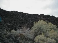
Scientists use forest color to gauge permafrost depth
Scientists regularly use remote sensing drones and satellites to record how climate change affects permafrost thaw rates -- methods that work well in barren tundra landscapes where there's nothing to obstruct the view.
But in boreal regions, which harbor a significant portion of the world's permafrost, obscuring vegetation can stymy even the most advanced remote sensing technology.
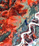
In a study published in January, researchers in Germany and at the University of Alaska Fairbanks' Geophysical Institute developed a method of using satellite imagery to measure the depth of thaw directly above permafrost in boreal ecosystems. Rather than trying to peer past ...