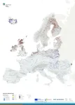
Launch of the most comprehensive, and up to date European Wetland Map
2nd February 2025 Greifswald/Aarhus/Helsinki - On time for World Wetlands Day, the European Wetland Map (‘EWM’) significantly enhances knowledge of wetlands across Europe by locating, assessing and merging the latest geospatial data. It combines various geographic information system (GIS) data on wetland types and their distribution on mineral soil in coastal environments, floodplains, and a large variety of peatlands in one most comprehensive, easily accessible resource. "Over a period of two years, we collected, checked and merged more than 200 geodata on wetlands and especially ...
Read the release